Going Suburban

Out bound buses loading at Northlands Mall, Christchurch July 2010. Immediately before the arrival of these buses several children on skate board, an elderly lady, and a young family with a child in a pushchair and another three or four year old held by the hand all had to walk out onto the road itself , and along gutter area the the path of incoming buses, to get past the large group of children and other bus patrons blocking the footpath. NZ in Tranzit suggests part of car park needs be purchased to give adequate room and shelter for patrons and safe through passage for pedestrians at this prime suburban exchange spot Photo; David Welch
Hey you can't say the loud-mouthed self opinionated dwatted wabbit isn't one hotshot journalist, he's so close behind the latest hot news its still positively steaming!! Catch this report he just chased to ground, the inside story -
"Furthermore in the city centre, and possibly in the principle suburban centres, it may be desirable to provide properly designed bus stations with shelter and other amenities for passengers and staff. This is particularly necessary for long distance road services which require terminals in the city centre."
p35 Christchurch Master Transport Plan Adopted in Principle 4 September 1962*
Violin strings playing, pages falling off a calendar, more pages, oops, calendars falling off a wall, walls cracking with age! Oops, the distinctive snorting snore and clacking noise as Father Time nods off and his false teeth clatter to the floor ....48 years of time travel later we arrive back in the present...dum de dah....
New Central City Bus Exchange Plans
- an opinion
New Central Bus Exchange - I am very impressed by the fly-over [it stretches my small brain - can such tiny cameras really be strapped to flies?] offered on The Press website. Cool. It has won its First award already - the premier Nine Carrot Gold award from you-know-who! I am impressed by the design and use of space and by the grand concourse. I am impressed by the multiple escalators/stairs wide enough to film a remake of the Battle of Potemkin staircase scene and this time better than ever with a twin size pram. I love the dappled light effect of the overhead three pronged boomerang structures (something similar in effect, utilising natural light creatively, really uplifts the whole feel of Britomart in Auckland). - an opinion
I am also glad to see (from the map in paper format Press) that only the corner shops on Lichfield are being demolished. The ones further southwards are hardly major architectural gems but I'd still like to think that either they will be saved or some new shops capturing something of the intimacy of the existing thoroughfare will be preserved. Too much open space created around a building can get plain bleak, a bit horribly UK 60s (and not swinging London). And this might be the case if no shops were left to line Colombo Street.
Although the new Exchange appears to be very much a "architectural statement building" with big angles and planes and heaps of window glass and marble (or whatever) I personally hope it is not going to be ONLY an "architectural" building - not toooo arty, remote and austere!
I dream of a living breathing colorful space. By this I mean somewhere off to the side from the underground bus zones there will also be pockets with warm cafes and newsagents etc and perhaps a mini-supermarket and a play centre other easily accessible resources. A bit like the Kampii complex in Helsinki [which dear reader have to look up yourself, the links to the underground shopping mall itself just don't fire on this blog and I don't speak Finnish, period].
And of course the new Bus Exchange will have a taxi rank and long distance bus station included. (This latter thanks to the masterly planning of 1962, speedily expedited, as one would expect in a city that gets more tourists than Hawaii!)
What really really excites me most of all is that we are seeing buses getting some of the investment and glamour so long only allocated to rail systems. Most people don't realise we have never really done buses in that way conceptually. Never "thought rail-built bus", built classy facilities with constant integrated flow of services. It is my opinion people and politicians in Christchurch [note the separate categories, the cheeky bastard ] have not even begun to understand what can be done with buses, or indeed what is being done overseas with buses. There is a whole dimension of public transport unexplored. Ironically it seems to me, we are within a hair's breath of being able to create a world leader small city in bus use, a magic computerised, co-ordinated 19 hour a day network, constant flow or travel direction choices in every direction. A key factor here is multiple node points with real time plasma signs, and press button link maps, options instantly seen, which ever way you go you can get to somewhere else.
Part of this would be multiple suburban bus exchanges...
Suburban exchanges and transfer node points
Big Jim's campaign is pitching it as a sort of either or scenario - if the central bus exchange goes underground we can't afford suburban exchanges. I disagree here, firstly because it inherently buys the National Party scenario of continuing to pump money into finishing northern projects that Labour started [admittedly the nats can hardly do otherwise!] while dumping on the south, knowing we will be too feeble to tough up for more.
I don't care where the economy stands or wobbles - a Government that can let country parents get off scot free - absolutely no school bus fares whatsoever, however token - and then ask taxpayers to fork out every penny of the $140 million plus cost to subsidise children in [what else?] almost entirely National Party electorates does not have a moral leg to stand, on in turning down Christchurch, the countries third city and a key tourist dollar pivot, for a few tens of millions.
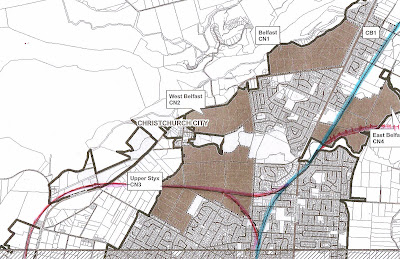
Secondly the essence of suburban exchange priority lies with concept, identifying and protecting the location and the timing of the buses. In other words getting a total game plan is the real key - the buildings can come later. In most likely cases the property needed (roading and footpaths) is already in Council hands, and probably only half a dozen properties need to be purchased (or sections of car park as in above area) near The Palms, Westfield and Eastgate malls.
Recently out of curiosity I plotted out locations where a bus transfer station would probably be valuable (in a properly integrated network that didn't run multiple services with similar functions simultaneously). These are points - usually intersections or shared road corridors beside local services areas and/or core-need retail providers - served by a least two bus services to the city and usually either a third suburb-city OR a crosstown service (Metrostar, The Orbiter, or cheekily a potential route from Papanui to Northlands via Burnside and Avonhead Mall I have pushed for a year or two) .
In all I identified 25 potential stations. Phew!! In 2006 the Metro/Council game plan there is only 9 suburban stations. This said the actual requirements in the infrastructure needed in two thirds of these transfer nodes would appear to be minimal - essentially mainly fairly normal bus stops immediately opposite each other or slightly staggered with a road narrowing to allow safe pedestrian passage at the rear of each bus stop and real time plasma signs to calculate transfer times. In some cases if outbound and inbound buses travel along the same stretch of road all stops can be on the same side. The ideal is to create (especially evenings and weekends) a co-ordinated pattern that feeds the multiple routes through these stations in a logical predictable and consistent way. In a well co-ordinated system an adequate safe zone and wind protected larger "roof over" style shelter is enough for these minor transfer points (not every meal needs to be a banquet!).
A key factor as a middle term goal would be to be able to guarantee that buses run to and from the city - by various routes - every 8 minutes in weekdays and every 15 minutes evenings and weekends from or to any one of these 24 nodal points.
We are a car addicted society and though Christchurch is too small and rotund in geogaphic size for park and ride (except perhaps Rangiora, Kaiapoi and Rolleston) there is much potential in everyone knowing the nearest regular flow bus station with a kiss and ride 2 minute parking zone to drop off or pick up spouses, kids, or guests with guaranteed 8/15 minute access to/from city centre.
And ditto, guarantee regular access to a major supermarket if the bus station itself is not at the supermarket or mall already, as most would be. This whole system is more a matter of using existing resources (timing and route planning) better and will probably need less than 10% service increase to achieve these constant flow patterns at 24 stations city wide. Hundreds of thousands of hours of bus operation time (and passenger time) are currently apallingly wasted each year through sloppy co-ordination.
I identify six major bus stations - Northlands, The Palms, Eastgate, Barringtons, Westfield and the University on Ilam Road, as primary ( I would imagine Metro does too). To me Barringtons and the Canterbury Uni multi-stops could be carried by broad piazza style platforms, "waisted street" loading zones and bedstead fencing to focus and protect movements, as described above. And some re-routing (for instance to access Barringtons transfer point, The Orbiter might make a minor added loop** around via Simeon Street to interact at the primary transfer stop presumably as now in Athelstan Street, with the several city-southwest routes.(and Governors Bay service and a busway via Hoon Hay Road to Birmingham Drive, the Uni and the airport in my vision).
(**when I say minor I mean this is a huge re-scheduling exercise, just to make the pattern two minutes longer !! But re-scheduling is the essence of suburban stations and successful nodal transfers points)
The other four exchange points in bold above need underground or overground access across busy roads and probably some adjoining property or carpark purchase to create large enclosed shelters and other major investment. Only these six stations, as named above, and perhaps five others, "intermediate" level transfer nodes (Belfast, New Brighton, Ferrymead, Hornby and Airport) would carry the constant traffic currently that suggests thought need be given to creating a partially enclosed (heated/cooled) waiting area. Which itself only needs to be open 6.30am -8.30pm or similar only - if sufficient verandha are is available outside these times (explained more fully here)
If money is short but a game plan exists, do they all need to be built at once? Do we have to go through the same farcial, stodgy, twenty two year process of making bus lanes?? Or rather lost opportunity and NOT making bus lanes and not least (appallingly) throwing away rare opportunities to build segregated bus corridors at key points like under the motorway at Annex Road and Grassmere St. across to Grimseys Road. Goodness we've waited 48 years already since the idea of suburban stations was first mooted - if the city develops a game plan of "what needs to go where" it can fill-in the jigsaw pieces as it goes and possibly do so cheaper in many cases than would otherwise be the case by combining the planned transfer node with roading redevelopment or associated new commercial developments.
For example if roading arrangements at some other less important identified exchange point is being upgraded or rebuilt for other reasons, why not do that bus station at the time, even if ahead of other possible priorities? Say for example the Merrin St/Withells Road roundabout was being converted to an intersection with traffic lights or to made the roundabout a bit more big vehicle friendly [as a sideline to my job across the last five or more years I have watched dozens of trucks and buses get half way round this road control and then have to back off to realign!!]. How much extra budget does it take to shape new curbing to accommodate a transfer node bus stop pattern in this shape instead of that shape? Or to build a bigger (but not necessarily fully enclosed) waiting station and wire in an overhead plasma sign at the time. To re-route the buses slightly to allow tight transfer between two (and possibly three or four) routes so transferring passengers can easily make the switch, ideally without having walking around into another street or across busy unprotected roads or (as at Barrington at the moment) navigate between four widely dispersed bus stops on different streets and sections of streets.
But even with suburban stations in sight (ok, ok, on a very distant horizon if you squint hard enough!!) it is hard for planners to make choices until the city knows exactly where it is going!
In my case I believe in an integrated network total mobility pattern I call NICERide - today's routes better timed and in a few cases slightly re-routed to criss cross in constant and predictable, interactive flow patterns, every hour the same according to only two variations.
In the NICERide scenario there are two underlying core patterns (A) 9am-6pm Mon-Sat; and (B) Mon-Sat 6pm-11pm and all day Sunday - during these hours the core services run to the same pattern every hour, either A or B pattern applying..additional services in the peak hour etc or middle of the day Sunday on one or two routes etc do not alter the underlying core service pattern, which is itself hugely user friendly for pulsed (alternating or staggered) services through each area and for transfers at node points along the way - ideally arrive from anyone of six directions/transfer to depart in any one of six directions. In this scenario having only nine big note transfer stations would be too little - yes they are needed but so too would be16 lesser identified transfer nodes, essentially mainly fairly normal bus stops immediately opposite each other or slightly staggered with a road narrowing to allow safe pedestrian passage at the rear of each bus stop and real time plasma signs to calculate transfer times.
I believe If Christchurch had a game plan of an integrated system of routes, rapid transit busways, express peak hour cross town options and co-ordinated bus timetables we could be sneaking in a city wide bus network as painlessly, cost effectively and little noticed or resisted as the current tramway (read light rail loop) being built in the central city!
Piggybacking costs and integrating construction into anyway planned or needed street reconstruction and upgrades, where real costs are minimized or spread, makes sense.
** Found hiding in the University of Canterbuty library in the most incredibly fusty and outdated section on public transport technolgy, concepts, planning this side of the black stump !

Comments
Post a Comment