Facts before Tracks

This photo is for entertainment purposes only and bears no relationship to anything in the article which follows!
Source US Library of Congress, commons.
Rabbit jump out at ya quote;
"I can't believe how much energy goes into surveying people already using buses rather the real market for growth - those NOT using buses!"
Over the years I have made several formal submissions to Metro regarding specific route change reviews, as well as several formal submissions to local or regional strategic transport plans. Sometimes I have just seen a possibility and sent an email to one of the senior planners or operations managers, floating the idea in case it has been missed. One such idea was the idea of "Spider Maps".
My theory - wild as it may sound!! - is based the idea work out where people are going to (by all modes including private car) and then build public transport to match - or if possible surpass - the ease of access offered by private car. Wendell Cox, US public transport consultant, claims only 25% of Christchurch employees work in the central city, a pattern consistent with many other modern cities. If Christchurch wants to really tackle congestion, pollution, time waste and unnecessary use of vehicles just for going to and from work, the city really needs to get far more accurate information about who is going where and when. I read or at least scan read a lot of City Council documents, include forecasts of growth in this or that area, or estimates of how many cars per day are expected along this or that road by 2015 etc. But it strikes me this information is still far too generalised for public transport planning. So many thousand cars per day through intersections A, B, C D etc, does not ultimately reveal where these journeys start from, where these journeys finish.
Trying to map these patterns and get a much more sophisticated picture of journey patterns in Christchurch would take enormous effort, perhaps a million dollar grant (from NZ Transport Agency!) but its potential to provide a much more precise planning tool, and a far more effective public transport systems, would make it money effectively spent. My concept is a targeted survey which includes a general broad map of all Christchuch, and a more specific map of say, 3km radius of the zone being surveyed. The survey might be undertaken by sociological students, on a part-time paid basis, working with Metro and people qualified in this field, in framing questions, organising systematic surveys etc. These would mainly be done at destinations (work zones employing 50 plus; study zones (from intermediate school to tertiary) ditto; carparks of major event centres). Several door to door studies of selected blocks might be done, just to see if they correlate from that end. In all about 10,000 people - a cross section of the city - might be interviewed. A key factor would be most them per se would NOT be bus users - I can't believe how much energy goes into surveying people already using buses rather the real market for growth - those NOT using buses! The ideal would be to repeat the same survey exactly after two years (partly to evaluate trends in growth and partly to see how radically patterns shift, if they do so at all) and then ever 5 years thereafter. I am assuming the size of the study would not see too many dramatic changes - if one in 35 employed persons living east of Marshlands Road work in, or near the Airport in 2010, I would imagine in 2015 this might be 1 in 37, or 1 in 32 - not suddenly only 1 in 100 etc
As well as answering a dozen key questions respondents are invited to mark with a felt pens the approximate pathway of their work/study journey across the city; on the smaller more detailed map the route by which they most often approach their prime work/study facility. It might not have the right public appeal, but I call them "spider maps" because if all these lines were fed onto a single map I imagine - perhaps quite wrongly - it would appear a bit like a spider. However most research results wouldn't need such a visual depiction, they could instantly accessed in a far more mundane but useful way. My thinking is that intrinsic to these maps would be a coded grid squares, and coded arterial roads, allowing information to be entered into a computer system systematically (eg D436VFVDVQA576) in which Dxxx is depart grid reference, V = via a coded arterial (vF =via Shirley Rd, vD= via Hills Road, vQ = Bealey Avenue etc) and Axxx is arrival (work/study zone). Theoretically - I am virtually computer illiterate but this doesn't seem like rocket science - it will be possible to pull up thousands of patterns from this data base. If 436 actually means grid box 36 in sector 4 then several levels of infomation can be obtained - how many sector 4 residents work/study in sector 9? Or sector 2? Or how many residents in the specific grid area 436 travel to A452 - the local mall - as their work place. And timing too. If 69% of people working in the Birmingham Drive enclave [a major employment area which bizarrely, currently has no bus service at all] start before 7.30 am, and 58% live within a 3 km radius then trying to get a shuttle effect, for instance from Westfield, offering a service every 10 minutes or less between 6.30am, may prove popular. Much more so than a half hourly service which comes from far greater distance (with only one really useful service, arriving at 7.20 am - but oh dear, miss that and not 5 or 10 minutes late, but a whopping 20 minutes late for work!!) .
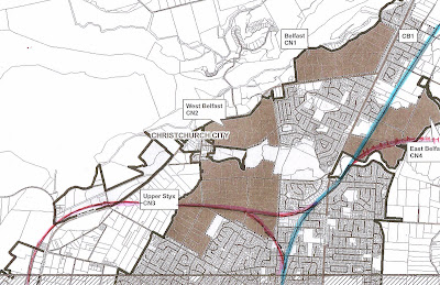
It should be possible to find some very strategic links, possibly of an express (non-stop) nature, across the city. We know for instance that over 5000 people work at the airport, and current services to the city (routes 3,10,29) now offer a very effective integrated service (albeit at some cost, in creating a very poor service to South Christchurch/Cashmere on Saturday nights and all day Sunday). But to get to the Airport from Rangiora, Kaiapoi, Belfast, Parklands, Halswell, Hornby, Rolleston etc by bus is currently virtually a non-starter, who could be bothered!! And how many work part-time - is there a start time for afternoon or evening workers that is more common than other times etc A survey might reveal that a nor-western express service with only limited stops, but hitting five key areas where larger number of airport employees live, could be valuable. Or, if it was revealed, that 73% of tertiary students or perhaps workers in some more labour intensive industry lived within 2km of their study facility or specific workplace, a shuttle pattern could be integrated to reach currently unserviced areas or reinforce existing routes feeding to this point at the appropriate times.
A route with a service every fifteen minute service is not to be sneezed at, as a generalization, but this is too long a headway for those making shorter trips. There is a natural ratio of waiting time to distance travelled; if the whole journey only takes 5 minutes by car, who wants to wait up to 15 minutes for a bus that takes a further 7 minutes to reach the same point? If they have a car they will choose that option most times. On the other hand if a shuttle system was established just for that local area, phased to run between the existing timetable sevices from further afield, bringing access down from 15 minutes to every 7 minutes, or every 5 minutes, leaving the car behind becomes a much more pleasant option. I call these short length high frequency workday services, looping out and back to a key central work zone and then looping out and back on the other side of the same zone, perhaps in a double 8 pattern, butterfly services,by virtue of the wing pattern. (Ok, ok, no more insects!). There are many options but the key aspect is to maximise the effectiveness of full time routes, supplementary services, and timing patterns. In trying to offer servives even remotely competitive with car use, needs absolute research commitment.
I am a great believer public transport is a science - and if it is not, if planners, operators administrators are casual about the fine tuning, consistent phasing of services, matching departure/arrival times to major work start times at all larger employment zones etc then they are just wasting the ratepayer and taxpayer dollar and treating potential passengers with a certain lazy contempt, which is always sensed and resented.
The current campaigns in Christchurch for light rail, or heavy rail, or even my tiny campaigns for bus rapid transit corridors, can only be childish conjecture. We don't know enough, to really create spot-on services, by any mode. Get the facts before the tracks!!!

Comments
Post a Comment