Hot-spot exposes a city falling far short of quality public transport

POOR ROAD USE
A couple of weeks ago, one rainy day, I was on a bus traveling up Papanui Road to Northlands. It was about about 3.30 pm. and already traffic was queueing.
The most impressive part of the bus journey was north of St Andrews College/Normans Road intersection -the bus fair flew along the bus lane, up the inside of a traffic queue until it got into the congestion at "the roundabout" (junction of Papanui Road and Harewood Road).
Then it got bogged in a queue and crawled up to the stop just past the Mobil Service Station on Main North Road. Understandably perhaps local retailers resisted bus lanes through this shopping area, and I respect there are places where roadside businesses need the image and illusion of of easy front door parking to survive. However after leaving the stop by the convenience store [opposite The Rose and Thistle pub] it probably took another two to three minutes, with a red light at Langdons Road, and in a stop-start queue [photo above] to travel the next 700 metres to the major bus stop outside Northlands.
This wasted time is instead of the 20 seconds this distance would take in a clear run situation if lights were designed to favour buses and buses had their own exclusive lane. It is hard to see the point of bus laning parts of Papanui Road if the three most congested areas -Victoria Street, Merivale and Papanui/Northlands - offer so little assistance to giving buses clear advantage.
The lack of commitment in Christchurch to public transport is fairly self evident if one notes the large unused footpath and ornamental border space in the photo above. Here is another photo of it, taken further back towards Langdons Road, immediately rear of position of top photo (ignore artistic condensation patterns on bus window!)

This suggests an added bus and bike lane could be accommodated and still leave room for a more than adequate pedestrian footpath. There is a wall of Westpac protruding onto the footpath, presumably they have figured there was more land than they needed. In an extreme case, negotiations by a Council committed to public transport could see this frontage area purchased and returned to public land, with a concrete arch over the footpath replacing the structural role of this protruding wall. Noted; Auckland is spending millions of dollars (including those sourced from Canterbury taxpayers) to enhance roading and public transport corridors, buying up over 500 private properties just on the AMETI scheme and Waterview Tunnel project alone - our city won't even negotiate a minor frontage purchase widening a road to give a better bus run! However there appears anyway, more than enough space for pedestrian, cycle and bus lane.
Where ever bus lanes are built close to the footpath it does no harm to build a bedstead fence and this situation it would also render the passage safe for sight handicapped people. Further purchases would need to be made of the meaningless ornamental box and frontage of Cash Converters - council might offer owners a far more attractive, thinner, ornamental box hedging, and build a slightly less wide footpath. Ditto along the frontage of the Northlands Mall car park where currently buses slide into the (ahem) Northlands Metro Suburban Transfer Station.
Not. Ok a rainy day makes it look worse. No propaganda photos please blogster!

Of course on a fine day it might look like the photo below taken in 2010 (noted - before the buses arrived several people including an elderly lady and a mother and small child had to walk onto the road to get past this thronged footpath).

This classy looking set-up is presumably one of the nine suburban bus stations promised by ECan and Council back in 2006. Yeah right.
The transport authorities in Christchurch had only four years before the earthquake to address the issue. Understandably only one such station, a fairly modest set-up at at Hornby, has ever been created.
At a rate of one suburban transfer station per four years (if Council can maintain the pace, phew!) expect completion of all nine by 2043.
But let us go back in "space" rather than forward in time and check out Main North Road as it approaches Langdons Road. As usual the dwatted wabbit (yes he still lurks somewhere in these pages) was carrying his camera. a couple of weeks after the top two photos, and noticed the following scenario -
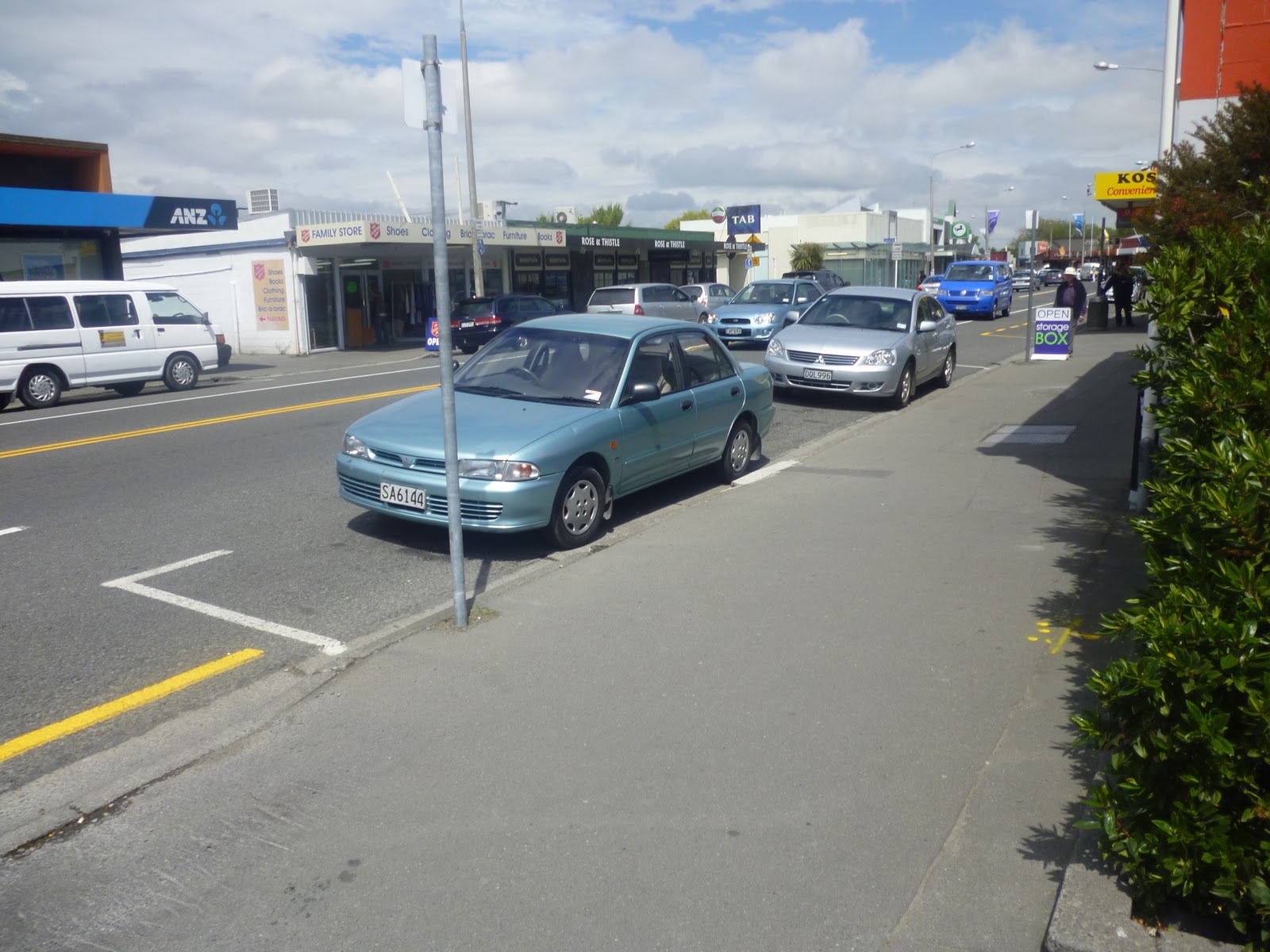
This is outside PostShop and KiwiBank (combined) in front of an area permeated with multiple car parks in lanes and back areas. It is looking in the opposite direction to the bus photos above and just by the blue car in the middle distance are the markings on the road for the bus stop by the convenience store.
The yellow line in front of the car parking bay for two or three cars leads right up to Langdons Road. Arguably if on road parking is needed at all it would be better as 5 minute parking in front of the convenience store and this lane have (a) a bus stop in front of Postbank then (b) a Bus Lane (bus only straight ahead, turning lane for cars) with intelligent signals to take buses straight through this congestion point onto a full time exclusive bus lane towards Northlands and a proper suburban exchange station.
My guess is be create an adequate transfer station the Council will need to work with Northlands Mall, perhaps insetting an enclosed waiting area into a small part of the Northlands carpark and narrowing the waist of the road to create safe passage across the road to a narrower bus shelter stop on the opposite side, copious use of bedstead fencing needed to channel pedestrian movements safely. The footpath area will needed to pass under the over arching veranda or around the back. As with Ottawa or Calgary in Canada CCTV will need to be clear and linked to a monitored centre which can focus to faces, move and track movements, and if need be security or police alerted. I believe vulnerable bus stations needing to be "safer than houses" - precisely the places that bad eggs avoid - rather than as often happens overseas, places that "normal" people avoid because they become hang-out spots for street people or idle but noisy youth to annoy others or worse, locations for drug dealing, panhandling, bullying and abusive behaviour.
Facilities such as toilets, baby change station, cycle rack at rear will also be necessary. Electronic touch maps city wide will probably be available - touch present location, touch desired destination and a ticket size information document spews out showing the next three options, by whatever transfer pattern pattern and travel time, between the two locations.
Entrances and exits to the Mall carpark may need to shifted slightly and work in with traffic lights for the buses. Real time signage for buses travelling in both directions will be needed, so it is possible for passsengers to evaluate all options.
POOR SCHEDULING
Bus services would need to be scheduled in a co-ordinated interactive way by professional bus planners not the current mish mash which would make a child blush with embarrassment at ineptitude and stupidity. Also for an organisation called Environment Canterbury - a hypocritical and gross waste of limited resources, all over town running rare evening and weekend services through key points and along shared corridors simultaneously - and then anything up to an hour gap.
Take these sample departure times below, from the "new look" post-quake timetables (mostly the same-old same-old recycled!), route numbers in brackets. This lists all services that run along the a shared 6km stretch of road, including that in the photograph above, a road which is probably one the busiest in northern Christchurch.
Effective resource use? You can judge for yourself.
City Central to Northlands via Papanui Road Saturday night (mins past hour)
04 (8) 07 (12) 24 (11) 58 (22) .....four buses an hour and still a 34 minute gap in services!!
City Central to Northlands via Papanui Road Sundays (mins past hour)
01 (12) 09 (8) 29 (11) 50 (22) 58 (22) daytime three services grouped between 50 and 09 and then nothing for 20 minutes, then nothing for a further 21 mins.
What a dogs breakfast - like something out of fifty years ago (or do I insult the past?)
What is so impossible about a core departure time pattern 10 25 40 55 - every 15 minutes during EVERY operating hour from 7pm Saturday morning to Sunday 9pm?
It would use no more buses than present or at most marginally so, just to cover swapping drivers.
Is this really so far beyond the abilities of ECan to work out? Any extra services such as 10 route or Saturday middle of the day services woven in at rational spacing, but the core pattern would remain rock solid and reliable.
What on earth is the point of our public transport system spending over $60 million a year (half from the public purse) to create a product that is not user friendly, fails to minimise and make predictable maximum wait time and offers patterns so fragmented, asymetrical and absurdly spaced as to be impossible to retain in the mind easily?
How many thousands more people would catch all day Saturday and all day Sunday bus services along this 6 km shared corridor (city via Victoria St, Papanui Rd and Main North Road to QEII Drive) - the busiest northern arterial in the city - if they knew this simple fact; that buses on this shared route corridor always run to a predictable pattern, every quarter of an hour from 7am Saturday morning to 12am Saturday night; and from 9 am to 9pm Sunday, additional services also on Saturday in middle of the day.
What idiotic system throws away the marketing appeal of this simple reliable concept, operating all the buses needed to supply it in a higgedly-piggedly mess?
Until Environment Canterbury can get its act together not only is it screwing the rate/tax and farepayers paying for this system, delivering half the service quality it could be for the same money and driving potential customers away, it also makes any possibility of (reliable) transfer stations slightly ludicrous. Why would anyone trust transferring between routes that run only two or three minutes apart? Or that can leave one standing at a transfer point for 34 minutes (or longer) between buses. .
SOME MORE FIGURES
In the period 3pm -6pm, even allowing that many buses are still running very low in patronage following the earthquake dusruptions and the closure of much of the CBD, this probably amounts to at least a 1000 passengers spread across 75 northbound buses.
Let us say enhancing bus lanes and traffic signal patterns at this area (notably the intersection with Langdons Road) could save, say, on average 1.5 minutes, or 1500 minutes of passenger time lost per business evening (= 25 hours per night, or 175 hours per working week or roughly 8750 hours per year. I am not including the, say, 20% of the time outside the 3pm - 6pm period, such as Saturday mornings where time could also be saved so this probably a very conservartive figure.
Of course, making buses not only faster, but felt as faster, does much to spur patronage. As well the city's steady revival will significantly spur patronage and it might be more realistic to say delays at this intersection cost bus commuters an expected 10,000 hours per year increasing to 30,000 hours per year in the next ten years as bus services fill up again.
The delay in queues can also tilt the balance in favour of car usage instead for those that have or choose this option. Let us say the Papanui/Main North Road chokepoints contributes to the loss of the potential weekly patronage of 300 individuals who commute to work or tertiary study etc each working day, averaging 10 trips per week (45 weeks per year - allowing annual holidays, statuary holidays and sickness). These are patrons who tried the service but decide against bus use because of perceived slowness and the Papanui-Northlands chokepoint is the image that most commonly springs to their minds when they tell others why they decided to buy or use a car instead. This prepresents loss of potential 3000 trips per week times 45 weeks a year = 158,400 passenger trips per year or (Metrocard) revenue of $138,000, one zone users only counted.
These figures are purely hypothetical but you can probably get the ghist!!
The battle to move buses from the back of the queue into the fastest and smartest way to get around the city is fought and won in seconds and minutes. Not least because if route gets to point A on time every working night, then passengers can transfer to bus B at the same location 10 minutes later. Which means predictability, reliability, easy to memorise travel patterns, journey options expanding exponentially.
When buses employ modern technology and are supported by local authorities and good scheduling they can cut the perception that buses only travel in one direction A to B, or K to S, rather than every service inherently takes you in every direction.
Although we often hear about how buses are subsidised we never hear about the real cost or costs that can be estimated of parking or Council's inaction or merely making token gestures towards public transport.
Why should ratepayers, taxpayers and bus users combined spend a whopping $68 million per year on a bus service that can't even deliver quality services on time, because Council will not create the necessary infrastructure. Is the real cost in lost status and effectiveness and patronage of buses into the tens of thousands.
If indeed we lose $138,000 of bus income, from this congestion point (one of about 20 around Christchurch) what is the real cost of subsidising those two or three car parks that make a clear run between two stops impossible, as shown by the placement of the carparks in the photo above? $10-20,000 per year?
++Clemens+Pasch+(sculpture).jpg)


Also need to reduce the number of stops, some areas it barely seems to go a block before there is another stop. So perhaps remove every second stop in some parts, or stop some buses at some stops and not others (although 1st option preferrable)
ReplyDeleteDisagree with having bus and cycle lanes anywhere near each other. The state govt in Sydney(NSW) thought it would be a great idea, but having the biggest and the smallest road users right next to each other is logically wrong and discourages cyclists. Better to make use of quieter backstreets for such networks. (there are plenty that run parallel to papanui rd for example.)