Can Sydenham afford to rebuild without re-zoning?
Interestingly I was back in Sydenham again yesterday and I don't think any part of the city is so consistently ravaged as the old commercial heart of Sydenham. The whole street from Colombo Street overbridge to Brougham Street and Sydenham Park is like a maze - every bit one side or other of the street fenced by safety fences or a wall of protective containers and narrowed to one way passage. It is not only the new bus lanes being built (below) that are somewhat obstructed!

The other side of this equation is that the damage is greatest because Sydenham still had a significant number of older - 19th century - shops, dating from its heyday as one New Zealand's most prosperous energetic towns. Underlying this is not so much committed preservation as the economic decline of the northern end of Sydenham as the centre of commercial activity. The home of most national chains and franchise has moved south of Brougham to the area opposite the park. A big factor here as with suburban shops and malls is the shops in this area offer extensive car parks immediately around the buildings.
A major question mark would seem to hang over Sydenham's blighted heritage buildings - can the owners/city afford to rebuilt which inherently must include strengthening and upgrading (not just the repairs covered by insurance) when the area itself appears to have been struggling for years to retain tenanted shops or accommodation above them?
Can Sydenham afford to rebuild heritage buildings when - and I hate to say this as a non-car owner and heritage lover - when the style of shops with only parking kerbside in front has become essentially an outdated technology?
Can Sydenham afford to rebuild without re-zoning?
In June I suggested that history has shown the conversion of the entire area from older working classes houses into industrial area was probably a mistake... it has created an enormous dead (at evenings, weekends) swathe separating the city and CBD from Southern suburbs. I suggested back then [regrettably in creating a link to the current item I somehow deleted this earlier posting!!] that the area between Gasson Street and Durham Street - one block each side of the central Colombo St corridor - should be given a special designation of mixed use allowing light industry, commercial and recreational and residential area, to be built side by side within certain noise/pollution parameters. My vision was of four to six storey apartments being built bringing a 24 hour a day life back into area, with light industry and wharehousing etc continuing cheek by jowl, recreating the more lively atmosphere of human activity that some people prefer - including immigrants, students, retired people who like to see the world at work around them [hopefully readers who never saw the June 19th article "Saving Sydenham" can get the ghist from this quick description]

This would be a 20-30 year evolution, a reversal of the previous trends within a specified area, but would generate its own special dynamic, attractive to certain people who prefer to live within noisier, more energetic and alive neighbourhoods. I believe the earthquake has accented the case for such a development, restoring heritage shops that are not the heart of a lively living community including residents seems pointless. From an opportunist viewpoint the removal of one or two damaged buildings, beyond saving, might also open up possiblity [again I hate to say it, but let's be realistic!] for more parking immediate adjacent to shops. Also for the creation of some attractive park and performance areas and enhanced landscaping.
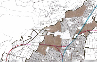
An added wild card factor here is the potential to build a railway station in the land immediately below the Colombo Street overbridge. Readers of past postings will know I don't believe Christchurch is big enough to sustain a commuter rail system but paradoxically also seem to be the only person advocating investigation of a double track railway line from Islington up past the Airport to Styx Mill (then to Belfast, Kaiapoi and Rangiora etc). This creates multiple passenger traffic generating points, needed to compensate for the relatively small size of population such a system might serve.
Lately my views have evolved a step further and I have come to play with the idea that both the current [slightly absurd] station at Tower Junction and the line between Addington and Papanui (perhaps even Styx) should be dumped completely. This land (except for the marvellous cycleway) could be sold off for commercial development (current station and area) and housing (current line through Fendalton-Bryndwr-Papanui) adding a bit to new rail funds. This puts all eggs into one basket - double or even in part triple tracking from city to Islington...with a rail trench under Lincoln Road and Whiteleigh Avenue...double tracking north and south from the threeway Islington rail junction. Entry to the city from the north on tourist and commuter rail via the Airport would add extra few minutes, but if the line is brand new, heavy duty, totally computerised and totally grade separated (all overbridges or underpasses, no level crossings) there is no reason for commuter trains not to achieve an attractive fast paced journey. To me the logical place to terminate such tourist and commuter trains is not Addington but at a new station built on the large apron of land immediately adjacent the former goods shed in the photograph below (or possibly in an attractive conversion, within them).
An interesting facet of this scenario - obvious in the photo below - is the by-pass effect of the current main lines for shunting and the passage of freight and coal trains to Lyttelton - unlike many other situations these would not run through the station area and platforms but around the outskirts, greatly minimising rail congestion and potential for accident. Possibly the sheds themselves could be flashed up into a classy station, long distance bus station and shopping mall....making the areas at the north of Sydenham prize real estate for office parks and residential areas - residents easily accessing major industrial zones ...Addington, Middlepark, Parkhouse, Hornby, Islington, Rolleston, Airport, Johns Road, Belfast etc . Or easily accessing those same areas and Sydenham and city for residents from Rangiora, Kaiapoi, Belfast, Styx etc. All that is needed to top off this combination is to build the northern busway I have long advocated, from Belfast rail/bus centre through to Grassmere (underpassing QEII drive and Cranford St) and then straight down Rutland and Caledonia and Durham Street.
It is a damn pity I think our city is too small to have a commuter rail system..............but it doesn't hurt to know where you are going well in advance....unlike normal future development transit corridors are linear and need very long term planning ...it only takes one or two new buildings to render a transit corridor inoperable or hugely more expensive to build. I don't know who owns this land but I can't imagine it will stay vacant and open, not built upon indefinitely!


The other side of this equation is that the damage is greatest because Sydenham still had a significant number of older - 19th century - shops, dating from its heyday as one New Zealand's most prosperous energetic towns. Underlying this is not so much committed preservation as the economic decline of the northern end of Sydenham as the centre of commercial activity. The home of most national chains and franchise has moved south of Brougham to the area opposite the park. A big factor here as with suburban shops and malls is the shops in this area offer extensive car parks immediately around the buildings.
A major question mark would seem to hang over Sydenham's blighted heritage buildings - can the owners/city afford to rebuilt which inherently must include strengthening and upgrading (not just the repairs covered by insurance) when the area itself appears to have been struggling for years to retain tenanted shops or accommodation above them?
Can Sydenham afford to rebuild heritage buildings when - and I hate to say this as a non-car owner and heritage lover - when the style of shops with only parking kerbside in front has become essentially an outdated technology?
Can Sydenham afford to rebuild without re-zoning?
In June I suggested that history has shown the conversion of the entire area from older working classes houses into industrial area was probably a mistake... it has created an enormous dead (at evenings, weekends) swathe separating the city and CBD from Southern suburbs. I suggested back then [regrettably in creating a link to the current item I somehow deleted this earlier posting!!] that the area between Gasson Street and Durham Street - one block each side of the central Colombo St corridor - should be given a special designation of mixed use allowing light industry, commercial and recreational and residential area, to be built side by side within certain noise/pollution parameters. My vision was of four to six storey apartments being built bringing a 24 hour a day life back into area, with light industry and wharehousing etc continuing cheek by jowl, recreating the more lively atmosphere of human activity that some people prefer - including immigrants, students, retired people who like to see the world at work around them [hopefully readers who never saw the June 19th article "Saving Sydenham" can get the ghist from this quick description]

An added wild card factor here is the potential to build a railway station in the land immediately below the Colombo Street overbridge. Readers of past postings will know I don't believe Christchurch is big enough to sustain a commuter rail system but paradoxically also seem to be the only person advocating investigation of a double track railway line from Islington up past the Airport to Styx Mill (then to Belfast, Kaiapoi and Rangiora etc). This creates multiple passenger traffic generating points, needed to compensate for the relatively small size of population such a system might serve.
Lately my views have evolved a step further and I have come to play with the idea that both the current [slightly absurd] station at Tower Junction and the line between Addington and Papanui (perhaps even Styx) should be dumped completely. This land (except for the marvellous cycleway) could be sold off for commercial development (current station and area) and housing (current line through Fendalton-Bryndwr-Papanui) adding a bit to new rail funds. This puts all eggs into one basket - double or even in part triple tracking from city to Islington...with a rail trench under Lincoln Road and Whiteleigh Avenue...double tracking north and south from the threeway Islington rail junction. Entry to the city from the north on tourist and commuter rail via the Airport would add extra few minutes, but if the line is brand new, heavy duty, totally computerised and totally grade separated (all overbridges or underpasses, no level crossings) there is no reason for commuter trains not to achieve an attractive fast paced journey. To me the logical place to terminate such tourist and commuter trains is not Addington but at a new station built on the large apron of land immediately adjacent the former goods shed in the photograph below (or possibly in an attractive conversion, within them).
An interesting facet of this scenario - obvious in the photo below - is the by-pass effect of the current main lines for shunting and the passage of freight and coal trains to Lyttelton - unlike many other situations these would not run through the station area and platforms but around the outskirts, greatly minimising rail congestion and potential for accident. Possibly the sheds themselves could be flashed up into a classy station, long distance bus station and shopping mall....making the areas at the north of Sydenham prize real estate for office parks and residential areas - residents easily accessing major industrial zones ...Addington, Middlepark, Parkhouse, Hornby, Islington, Rolleston, Airport, Johns Road, Belfast etc . Or easily accessing those same areas and Sydenham and city for residents from Rangiora, Kaiapoi, Belfast, Styx etc. All that is needed to top off this combination is to build the northern busway I have long advocated, from Belfast rail/bus centre through to Grassmere (underpassing QEII drive and Cranford St) and then straight down Rutland and Caledonia and Durham Street.
It is a damn pity I think our city is too small to have a commuter rail system..............but it doesn't hurt to know where you are going well in advance....unlike normal future development transit corridors are linear and need very long term planning ...it only takes one or two new buildings to render a transit corridor inoperable or hugely more expensive to build. I don't know who owns this land but I can't imagine it will stay vacant and open, not built upon indefinitely!

Saving Sydenham might take vision and imagination more than just money. It might take more than painting by numbers, it might need to go beyond the writing on the wall...it might need tagging the area fror future use, now...... (and other puns to weak to be worth using as an excuse to include one small sample part of the magnificent multi-panel tag art wall on this building)


I see "The Press" (Mainlander article on Saturday) also identifies Sydenham as among the worst hit and least economically in the position to make easy recovery
ReplyDelete